Introduction
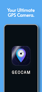
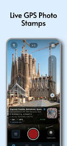
GeoCam Pro - GPS Map Camera is a camera app that records location and map information with each photo. It embeds GPS coordinates, address, altitude and timestamp into image metadata and offers optional map overlays and coordinate text on photos for clear documentation and reporting.
Key features
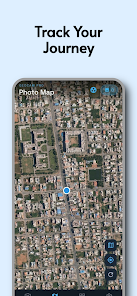
- GeoCam Pro - GPS Map Camera saves geotagged photos with EXIF GPS coordinates and readable address details for each image.
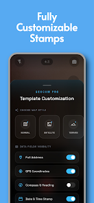
- Optional on-photo overlays: add a small map, coordinates, altitude, compass direction or custom text to captured images.
- Multiple coordinate formats supported, including decimal degrees and DMS, plus configurable timestamp format.
- Adjustable GPS accuracy settings and location capture methods to balance precision and battery use.
- Quick sharing options: export images with or without embedded location data to social apps, email or cloud storage.
How to use
- Grant location and camera permissions, configure overlay and metadata options in settings, then capture photos as usual.
- Select whether to embed coordinates in EXIF, include an on-image map overlay, or apply visible coordinate text.
- Use the preview to verify overlays and adjust font, color, size or map zoom before saving.
Privacy and settings
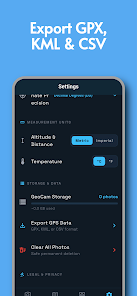
- GeoCam Pro - GPS Map Camera stores location data in image metadata by default; you can disable embedding or remove location data before sharing.
- Settings include options for offline maps, language selection and automatic filename patterns that include date and coordinates if desired.
- Images remain on your device unless you choose to share or upload them; review app permissions to control access to location and storage.
- No virus
- No advertising
- User protection
Information
- File size: 27.00 M
- Language: English
- Latest Version: 1.0.4
- Requirements: Android
- Votes: 350
- Package ID: com.geocam.geocam_flutter
- Developer: Nishanth Aradhya
Screenshots


Explore More
Explore the Latest Free Downloads of Top Photo Apps in 2024, Featuring Multi-Dimensional App Rankings and Recommendations for the Best Photo Applications. All apps are virus-free, safe and secure for your peace of mind.

Chennai Super Kings
Fruits and Vegetables for Kids

TriviaMaker

HTC Net

Prophecology

PearDrop

Cultura y Turismo Qro
Remote Control for TV