Introduction
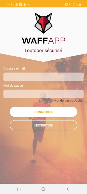
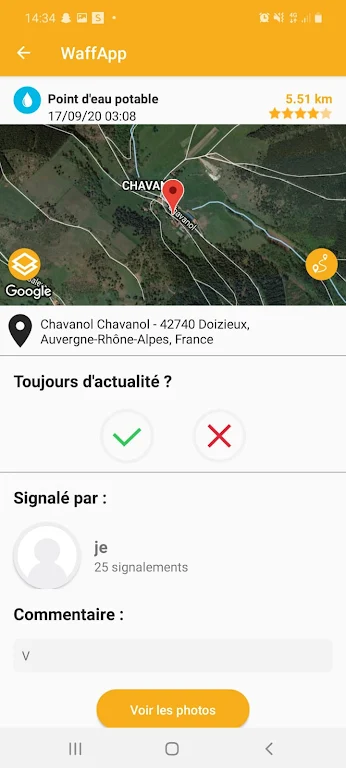
We introduce you to WaffApp, a collaborative and free application designed for nature enthusiasts of all levels, including runners, trail runners, Nordic walkers, hikers, and mountain bikers. This app aims to ensure the safety of your outdoor activities by providing information on potential dangers and useful points of interest on a geolocated map. During your activity, the app will warn you when you approach a specific area, allowing you to report or confirm encountered dangers and share useful information in real time or after your outing. After your activity, you have the option to update incidents reported by other WaffApp users, either through photos or comments. This valuable community-driven app includes incidents such as dangerous dogs, tick zones, natural waste dumps, closed or unmarked paths, and active hunting areas. Additionally, it helps you locate drinking water points and points of interest along your route, providing directions to each.
Features of WaffApp:
> Safety and security: This app provides a platform for users to share and report potential dangers and hazards along outdoor routes such as aggressive dogs, active hunting zones, impassable or dangerous paths. This ensures that users can have a safer and more secure experience during their outdoor activities.
> Useful information: This app offers valuable information such as points of interest, panoramic views, natural sites, and accommodations like lodges along the route. Users can easily access these details through the geolocated map feature, allowing them to plan their activities and explore new territories more effectively.
> Collaboration and community: WaffApp is a collaborative platform where users can contribute by reporting incidents, sharing photos, and leaving comments. This fosters a strong community of outdoor enthusiasts who can help each other stay informed and connected.
> Easy to use: The application is designed to be user-friendly, with a simple and intuitive interface. Users can easily navigate through the different features and functions, making it accessible to users of all levels, from beginners to experienced athletes.
FAQs:
> Is it only for specific sports?
No, it is suitable for practitioners of various outdoor sports such as running, trail running, nordic walking, hiking, and mountain biking. It caters to all levels of skill and experience.
> Can I use it offline?
Yes, the application can be used offline once you have downloaded the necessary maps and data. This allows users to access important information even in areas with limited or no internet connection.
> How accurate and up-to-date is the information provided?
The information on WaffApp is constantly updated by the community of users. The collaborative nature of the app ensures that incidents and points of interest are reported and validated in real-time. However, it is always recommended to use the app as a supplementary tool and be mindful of personal judgment and local regulations for safety.
Conclusion:
With WaffApp, outdoor enthusiasts can have a more enjoyable and secure experience by accessing important information about potential hazards, points of interest, and water refills along their chosen routes. This collaborative application allows users to contribute and benefit from a community-driven platform where experiences and incidents are shared in real-time. The user-friendly interface ensures that all levels of practitioners can easily navigate and use the app. WaffApp provides a comprehensive solution for those who want to explore the outdoors with confidence and make the most out of their outdoor activities.
- No virus
- No advertising
- User protection
Information
- File size: 26.10 M
- Language: English
- Latest Version: 10.4.1
- Requirements: Android
- Votes: 100
- Package ID: shrinkcom.waffapp.com
- Developer: WaffApp Android
Screenshots
Explore More
Explore the Latest Free Downloads of Top Photo Apps in 2024, Featuring Multi-Dimensional App Rankings and Recommendations for the Best Photo Applications. All apps are virus-free, safe and secure for your peace of mind.

Camera360

Photo Recovery: Restore Pics

Logo Maker Plus

AI Mirror: Hugs Video & Photo

GuruShots: Photo Game

FaceLab Photo Editor

Photo Blender: Mix Photos

pCloud: Cloud Storage


