Introduction
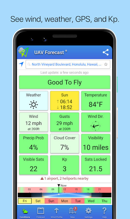
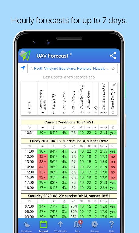
Looking to take your drone for a spin but unsure of the weather conditions? Look no further than UAV Forecast. This handy app brings together all the essential information you need before taking flight. With a quick glance, you can see weather forecasts, GPS satellite availability, solar activity, and even No-Fly Zones and flight restrictions. It's the perfect tool for drone enthusiasts using DJI Spark, Mavic, Phantom, Inspire, 3DR Solo, Parrot Bebop, or any other Unmanned Aerial Vehicles and Systems. Don't let uncertain conditions ground your drone – let the app be your go-to guide for smooth and safe flights.
Features of UAV Forecast:
> Weather Forecast:
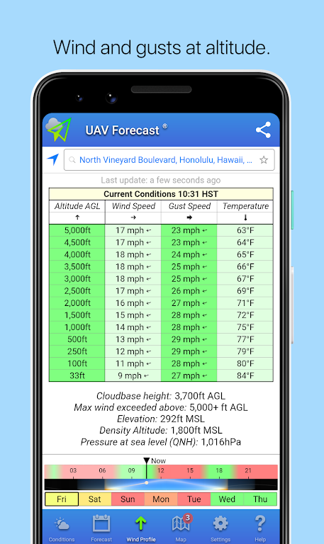
UAV Forecast offers real-time weather updates, allowing you to plan your drone flights accordingly. By providing accurate and up-to-date information on temperature, wind speed, humidity, and precipitation, the app ensures that you can make informed decisions about when to fly your quadcopter. No more surprises from sudden weather changes that could potentially damage your drone or hinder your flight experience.
> GPS Satellites:
To ensure precise and reliable drone navigation, the app provides you with the number of available GPS satellites overhead. By giving you this vital information, the app lets you assess the GPS signal strength in your location. With a strong GPS connection, you can fly your drone confidently and enjoy smooth, stable flights without the fear of losing control.
> Solar Activity (Kp):
UAV Forecast takes solar activity into account to keep you informed about potential interferences during your drone flights. By monitoring the Kp index, which measures geomagnetic disturbances caused by the sun, the app helps you predict the probability of GPS signal disruptions. Avoiding flights during times of high solar activity ensures greater reliability and reduces the risk of losing control of your drone.
> No-Fly Zones and Flight Restrictions:
The app comes equipped with comprehensive information about no-fly zones and flight restrictions, guaranteeing that you fly your drone within legal boundaries. The app alerts you to restricted airspace areas, such as airports, military bases, and national parks, to help you navigate safely and responsibly. By avoiding these restricted areas, you can protect your drone, prevent accidents, and comply with local drone regulations.
Tips for Users:
> Maximize Optimal Flying Conditions:
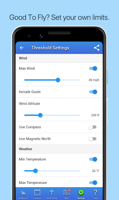
With the app, you can plan your drone flights during favorable weather conditions. Avoid windy or stormy days to ensure smooth and controlled flights. Opt for days with mild temperatures and low humidity levels to protect your drone from potential damage. By maximizing optimal conditions, you can make the most out of every flight, capturing breathtaking aerial photographs and videos.
> Fly Within GPS Signal Coverage:
Monitoring the number of GPS satellites available through the app helps you determine the best flying locations and identify areas with potential interference. Fly in open spaces and avoid obstructive environments to ensure a strong GPS signal lock. This way, you can navigate your drone with precision and confidence, capturing stunning footage from above.
> Stay Updated on Flight Restrictions:
Utilize the app to stay informed about no-fly zones and flight restrictions in your area of operation. Before heading out to fly your drone, check the app for updated information on local airspace regulations. By adhering to these restrictions, you can ensure the safety of other aircraft, people, and property. Additionally, complying with the law prevents legal consequences and fosters a positive image for the drone community.
Conclusion:
With its comprehensive weather forecast, GPS satellite monitoring, solar activity tracking, and information on no-fly zones and flight restrictions, this app provides all the necessary information to ensure safe and enjoyable flights. By following the provided playing tips, you can harness the full potential of your drone while adhering to the law and maintaining responsibility as a drone pilot. Download UAV Forecast now and take your drone flying to new heights!
- No virus
- No advertising
- User protection
Information
- File size: 37.40 M
- Language: English
- Latest Version: 2.9.10
- Requirements: Android
- Votes: 273
- Package ID: com.uavforecast
- Developer: Good To Forecast
Screenshots
Explore More
The Map Navigation Software Collection features a wide range of navigation apps, addressing the issue of friends being unsure of their way when heading out. These apps provide precise navigation for users and adjust routes based on real-time traffic conditions to ensure users reach their destination quickly.

Speech Assistant AAC

Beauty Parlour Course

Norgeskart
Garmin Motorize

Bliss Smart Blinds

Action Launcher: Pixel Edition

LPA Park

L'Express : infos & analyses
