Introduction
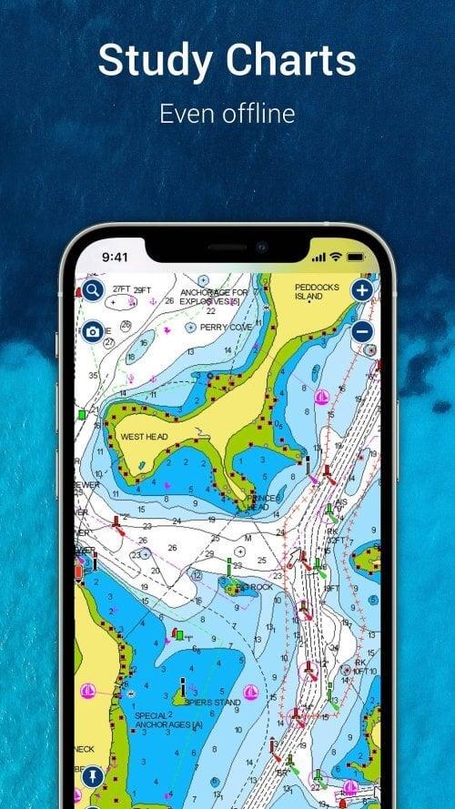
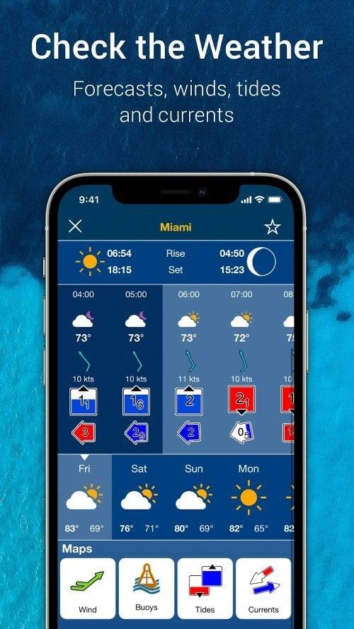
Navionics® Boating is the ultimate app for boaters, anglers, and sailors who understand the importance of having the right tools. With up-to-date charts and a range of features, this app makes navigating the water easier and more fun.The app also includes a nautical chart, which is a top maritime reference that provides detailed information on port layouts, anchorages, safety depth contours, and more. And if you're sailing in the US, Canada, Mexico, the Caribbean, or Brazil, you'll have access to U.S. Government Charts from NOAA.But Navionics Boating isn't just about charts. It also boasts an active and helpful community. Through Community Edits and the ActiveCaptain Community, you can learn from and share your local expertise with thousands of other boaters. You can also find local attractions, navigation aids, and get expert advice.
Features of Navionics® Boating:
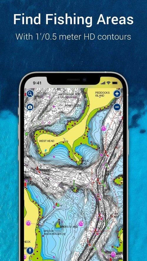
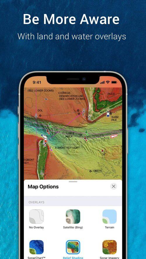
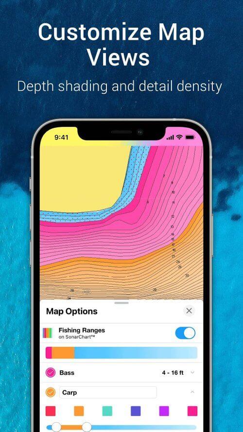
❤️ Reliable and up-to-date charts: The app offers downloadable Navionics charts and overlays, as well as SonarChart HD bathymetry maps with detailed bottom contour information. It also provides access to U.S. Government Charts for various regions.
❤️ Active and helpful community: Users can connect with a large community of boaters through Community Edits and the ActiveCaptain Community. This allows them to share local expertise, find local attractions and navigation aids, and receive expert advice. It also enables them to stay in touch with friends and fellow boaters, share positions and routes, and transfer data to chartplotters.
❤️ External device-friendly: The app seamlessly integrates with compatible chartplotters, allowing users to transfer routes and markers between the app and their chartplotter. It also supports SonarChart Live Mapping, which enables real-time map creation while navigating. Additionally, users can connect a suitable AIS receiver to Wi-Fi to view maritime traffic and receive collision notifications.
❤️ Daily updates: Navionics Boating provides daily updates with thousands of changes globally. This ensures that users always have the latest information, including updates to bottom topography, navigation aids, and maritime services. The accuracy of the data is maintained through regular updates.
❤️ Free trial period: The app offers a limited period for users to try it for free. This allows users to experience the benefits and features of Navionics Boating before making a purchase decision.
❤️ Easy to use and fun: Navionics Boating makes boating easier and more enjoyable with its user-friendly interface and comprehensive set of features. Whether you're a boater, angler, or sailor, this app provides the necessary tools for a better boating experience.
Conclusion:
Navionics® Boating is an essential app for water enthusiasts. With reliable and up-to-date charts, an active community, compatibility with external devices, daily updates, a free trial period, and a user-friendly interface, this app offers everything a boater, angler, or sailor needs to make their time on the water safer and more enjoyable. Click to download now and start exploring the features of Navionics Boating today.
- No virus
- No advertising
- User protection
Information
- File size: 248.94 M
- Language: English
- Latest Version: 17.0.2
- Requirements: Android
- Votes: 139
- Package ID: it.navionics.singleAppMarineLakesHD
Screenshots
Explore More
The Map Navigation Software Collection features a wide range of navigation apps, addressing the issue of friends being unsure of their way when heading out. These apps provide precise navigation for users and adjust routes based on real-time traffic conditions to ensure users reach their destination quickly.

MAW: My 3D Anime Wallpaper

World English Bible

Speech Assistant AAC

Beauty Parlour Course

Norgeskart
Garmin Motorize
Bliss Smart Blinds

Action Launcher: Pixel Edition
You May Also Like
Comment
-
Would have gave a 5 star but after buying it twice which said "Lifetime" both times and having it "expire" so I need to purchase again makes me feel robbed and ripped off. I refuse to give this app anymore of my money until they fix this problem. Plus my fishing electronics can do everything this app can and mark fish. Don't waste your money and spend a little bit on humminbird , you'll thank me later2024-06-24 04:23:05
-
Like others, I found my subscription had expired and was quite disappointed. I do not need the premium features it now offers and will also likely not be renewing. I do not need half the area and lakes that it covers within Canada and USA and wouldn't use it..too bad as I liked the app for years..2024-06-23 18:14:58
-
I have had this app for a number of years, and actually promoted Navionics to many. What does Life time actually means, Does it mean when the Earth Turned Flat, that my Lifetime subscription is no longer valid due to the earth not being round. Do I get my lifelong subscription back if the Earth is round. Which I can prove simply by typing an essay on here about "Tides". Stop answering Consumers concerns like Politicians. Going from **** to * is a deep fall, and a hard swim to the surface.2024-06-23 14:00:03
-
Paid for a lifetime membership and now they want me to $49.99/yr. Lifetime is lifetime and they don't want to honor it. My maps still worked in 2023 despite them stating it discontinued in 2020.2024-06-22 07:50:06
-
Considering subscribers contribute data for the maps and community the price is unreasonable. I've used navionics for years and the fact I have to pay sub for phone and my fish finder is ridiculous. I'm pretty sure over 200 for both for a year.. I'll use alternatives for now2024-06-22 01:57:04
-
where to begin. first off these guys want a subscription for something the app could do on its own. I get updated maps for a cost. but subscriptions are just an excuse to get extra cash from people. secondly the app doesn't work. I used the website and it worked like a charm. but when trying to plot on the app it always comes up as an error and then has a straight line. and if I try to load the route done on the website it just crashes the app. my boat device does all this for free. and works.2024-06-20 19:48:01
